Home Home
  • IDS
    • Quick reference list
    • Organization
      • About IDS
      • Terms of Reference
      • Structure
      • Governing Board
      • Central Bureau
      • Analysis coordination
      • Combination Center
      • Data Centers
      • Analysis Centers
      • Associate Members
      • Working Groups
    • Data & Products
      • Tables of Data & Products
      • Information & data center organization
      • Data structure and formats
      • CDDIS Data Center
        • Web site
        • Archive (authenticated access)
      • IGN Data Center
        • Ftp site at doris.ign.fr
        • Ftp site at doris.ensg.eu
      • Central Bureau ftp site
    • Documentation
      • Overview
      • Meeting presentations
        • OSTST meetings: session Precise Orbit Determination
        • IDS-related presentations
        • IDS AWG 11-2025
        • IDS AWG 03-2025
        • IDS AWG 06-2024
        • IDS Workshop 2024
        • IDS AWG 11-2023
        • IDS AWG 04-2023
        • IDS Workshop 2022
        • IDS AWG 06-2022
        • DORIS Days 2021
        • IDS AWG 04-2021
        • DORIS Day 2020
        • IDS AWG 09-2019
        • IDS AWG 04-2019
        • IDS Workshop 2018
        • IDS AWG 06-2018
        • IDS AWG 05-2017
        • IDS Workshop 2016
        • IDS AWG 05-2016
        • IDS AWG 10-2015
        • IDS AWG 05-2015
        • IDS Workshop 2014
        • IDS AWG 03-2014
        • IDS AWG 10-2013
        • IDS AWG 04-2013
        • IDS AWG 09-2012
        • IDS Workshop 2012
        • IDS AWG 05-2012
        • IDS AWG 05-2011
        • IDS Workshop 2010
        • IDS AWG 10-2010
        • IDS AWG 05-2010
        • IDS AWG 03-2009
        • IDS Workshop 2008
        • IDS AWG 06-2008
        • IDS AWG 03-2008
        • IDS Workshop 2006
        • IDS Plenary meeting 2004
        • IDS Workshop 2003
        • IDS Workshop 2002
        • DORIS days 2000
      • Newsletter
      • DORIS bibliography
        • Overview
        • Citation
        • Peer-reviewed journals
        • On-line publications
      • Outreach material
      • Mails
      • Governing Board
        • IDS Activity report 2023
        • IDS Activity report 2022
        • IDS activity report 2021
      • Central Bureau
      • Analysis coordination
    • Meetings
      • IDS Meetings
      • Meetings relevant for IDS
      • Other Calendars
    • Contacts & links
      • Contacts
      • Links
      • Directory
    • Gallery
  • DORIS System
    • The DORIS technique
    • Tracking Network
      • Overview
      • Site Logs
      • Station management
      • Station position time series
      • Maps
      • Network on Google Earth
    • Satellites
    • System monitoring
      • Overview
      • Table of events
      • Orbit residuals
  • Analysis coordination
    • Presentation
    • Combination Center
      • Activity & Products
      • Cumulative solution
      • DPOD
      • Contributions to ITRF
        • ITRF2020
        • ITRF2014
        • ITRF2008
    • Documents for the data analysis
    • Preparation for ITRF2020
    • About DORIS/RINEX format
    • Analysis related events
    • Discussion
  • Web service
    • Description
    • Station position
    • Orbit residuals
    • Combination parameters
    • Earth Orientation Parameters
    • Position residuals
    • Network viewer
  1. Home>
  2. Table of documents>
  3. Network>
  4. Maps

Maps

Maps

Maps

Here is a selection of maps of the DORIS network.

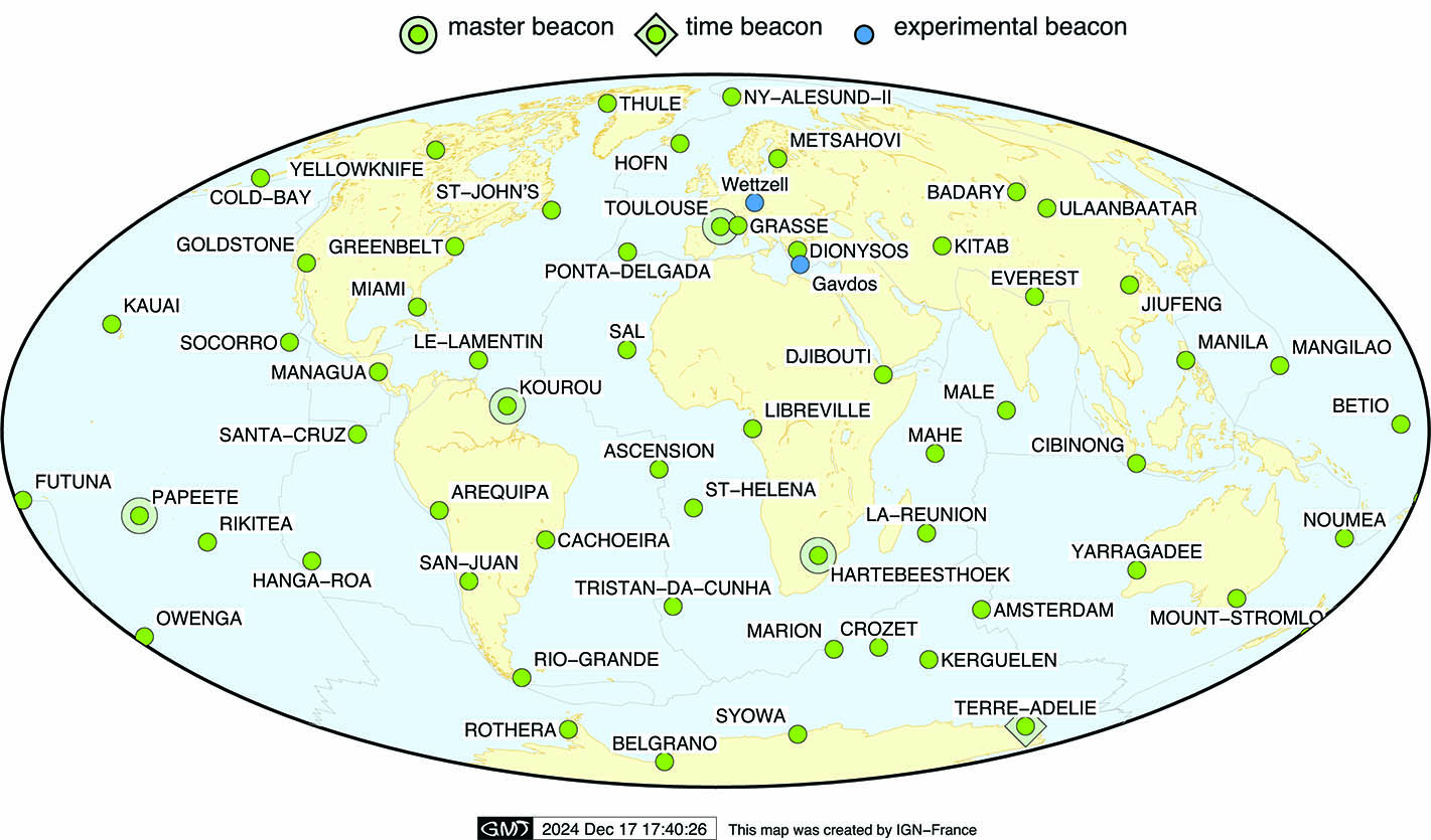
DORIS sites

DORIS sites (as of December 2024)


Map of the current DORIS network

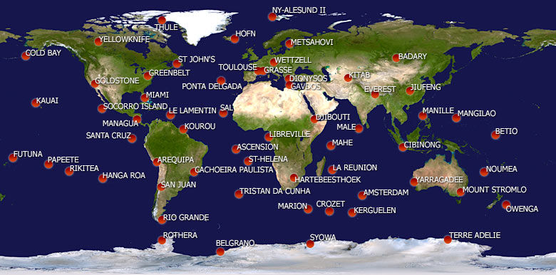
DORIS permanent network


Current DORIS network


DORIS network 2020


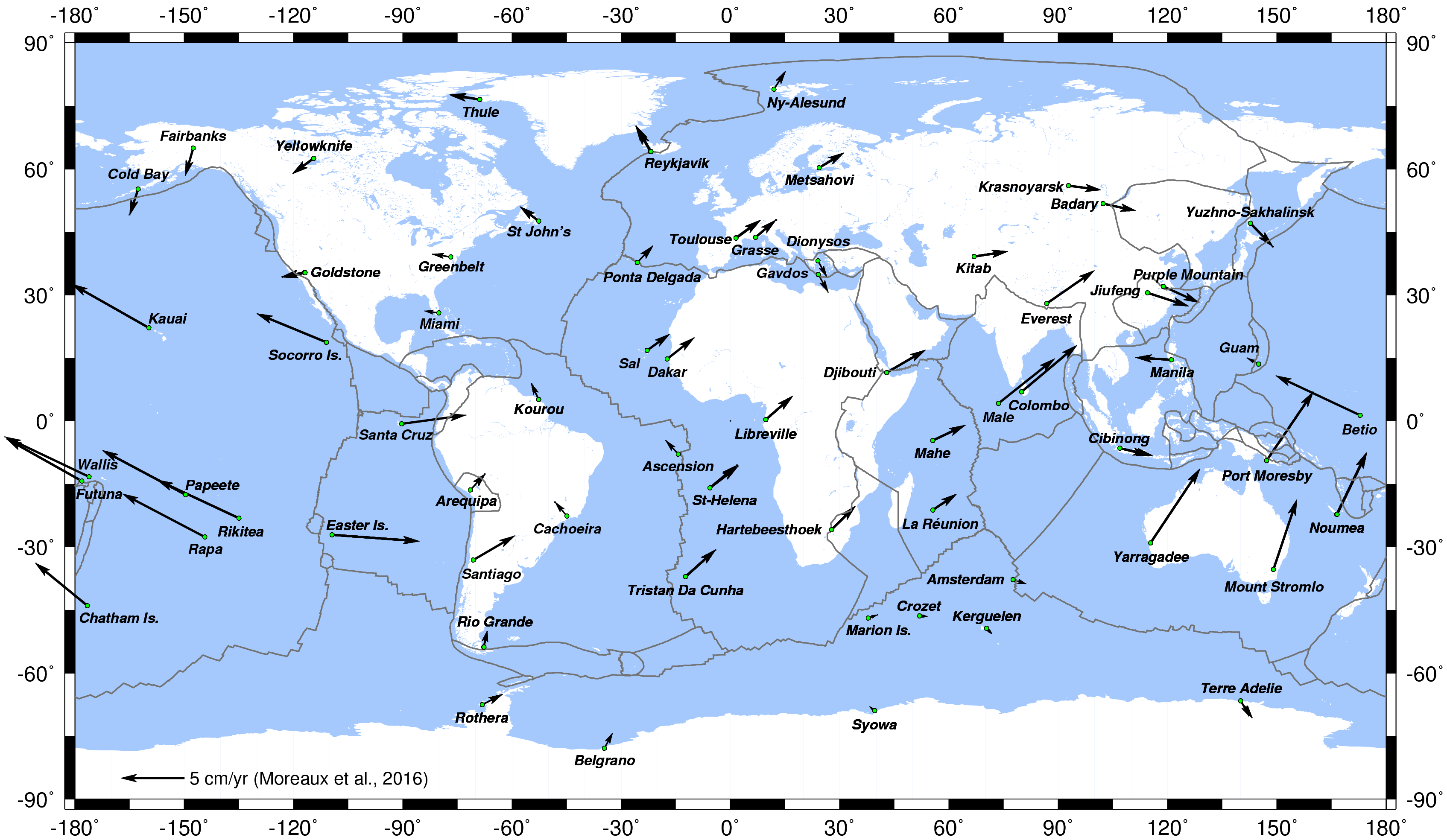
Horizontal displacement of the DORIS stations (Moreaux et al., 2016)

DORIS network 2020


Horizontal displacement of the DORIS stations


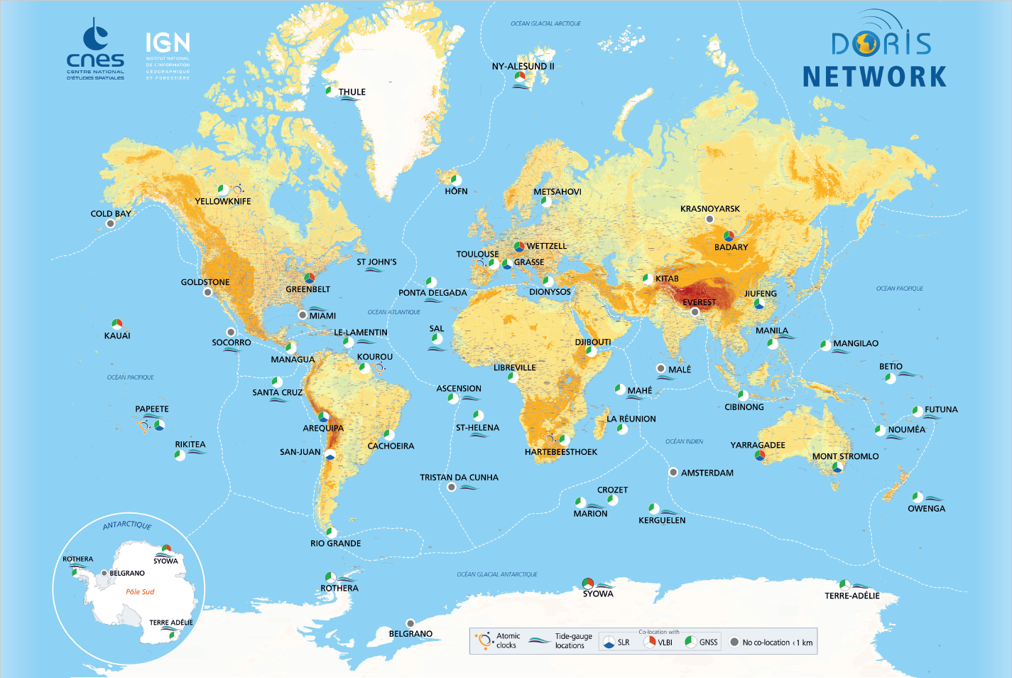
DORIS colocations

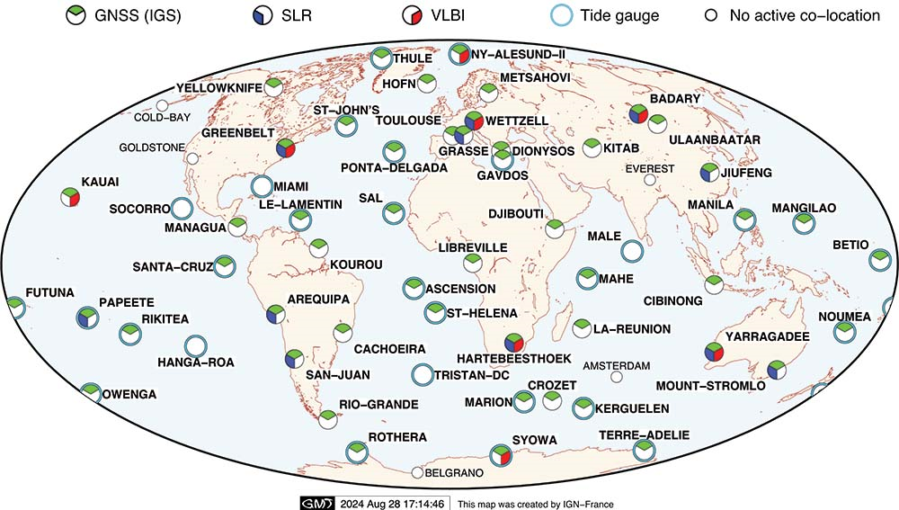
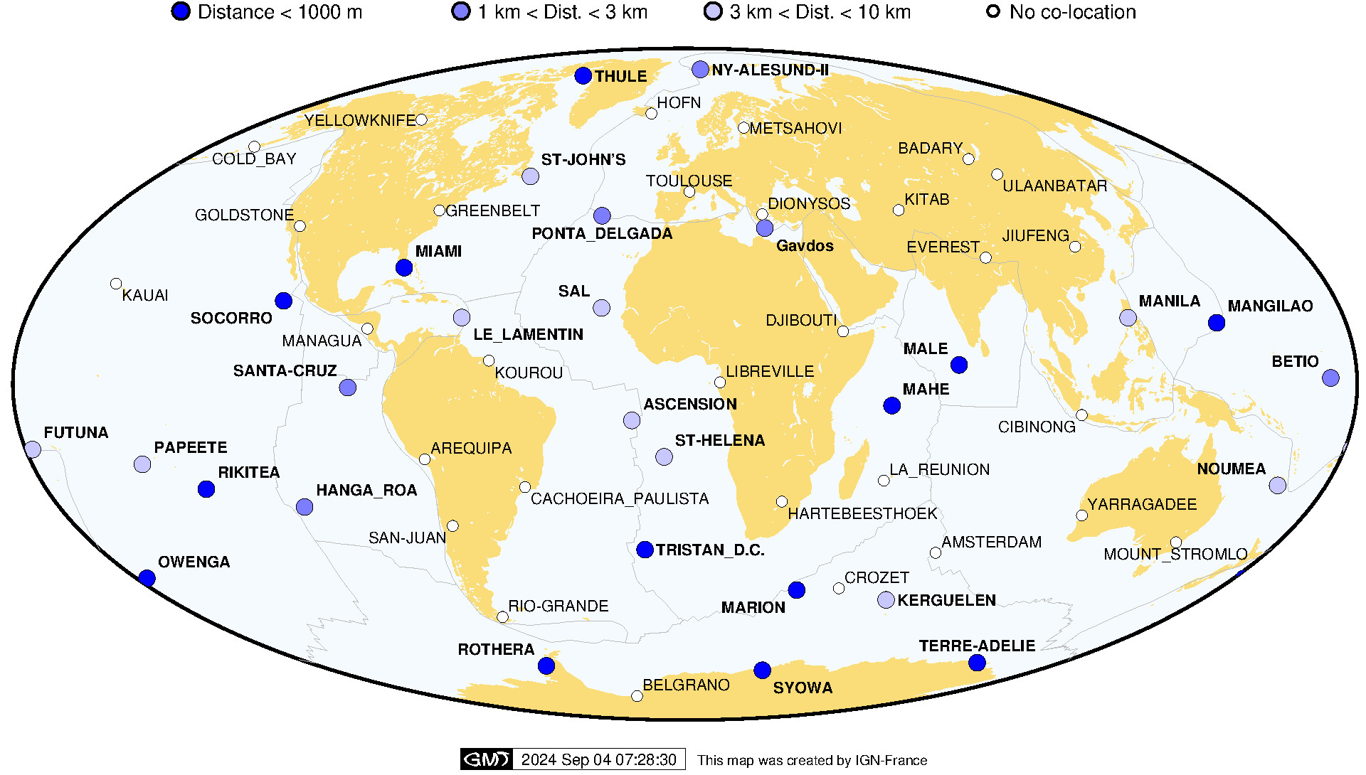
DORIS stations co-located with other IERS techniques and tide-gauges (as of Sep. 2024)


DORIS and tide-gauges colocations (as of Sep. 2024)

Colocation DORIS IERS techniques and Tide Gauges


Colocation DORIS Tide Gauge


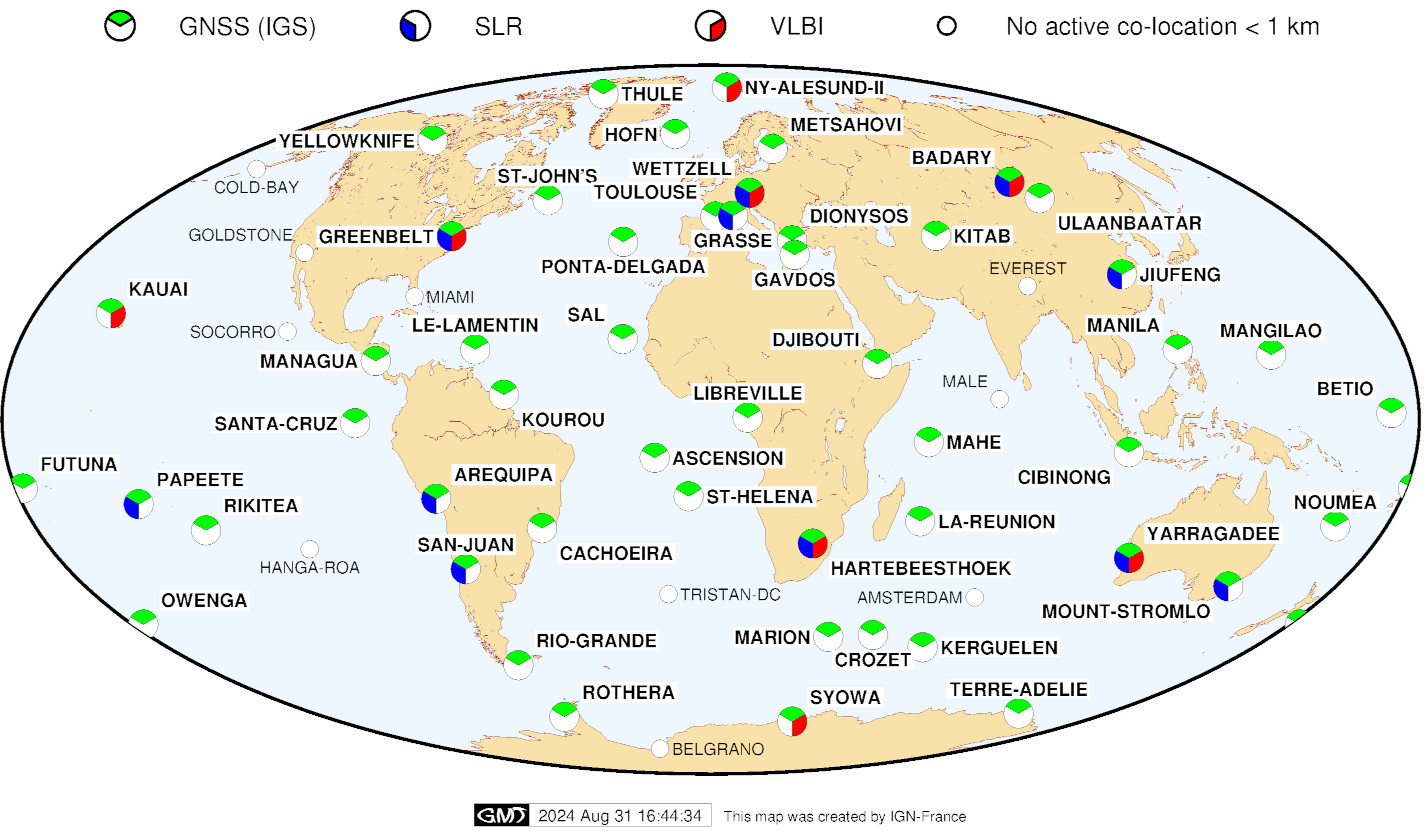
DORIS stations co-located with other techniques (VLBI, SLR, GNSS) (as of Sep. 2024)

See the evolution from Jan. 1993 to Nov. 2016


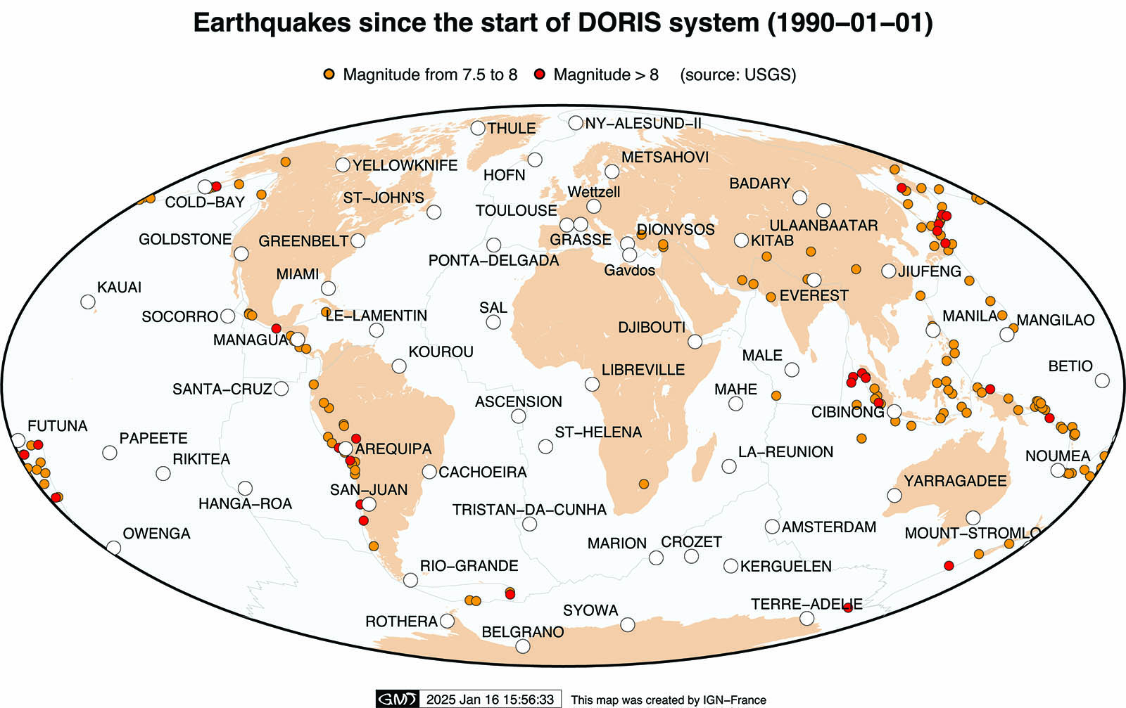
DORIS network and Earthquakes since 1990 (as of Jan. 2025)

Colocation DORIS IERS techniques


Colocation DORIS Earthquakes


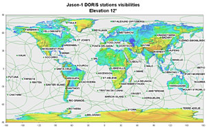
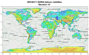
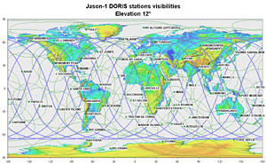
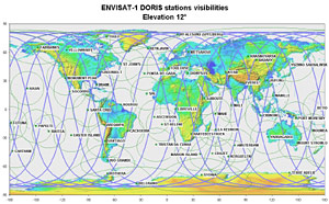
Satellite tracks and visibility circles

Jason-1   ENVISAT

Jason-1 DORIS stations visibilities, elevation 12° (2006-12-08):


ENVISAT-1 DORIS stations visibilities, elevation 12° (2007-03-07):


Jason-1 DORIS stations visibilities, elevation 12°, and satellite tracks for 1 day (2006-12-08):


ENVISAT-1 DORIS stations visibilities, elevation 12°, and satellite tracks for 1 day (2007-03-07):


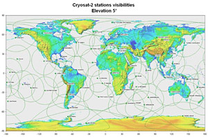
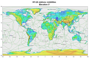
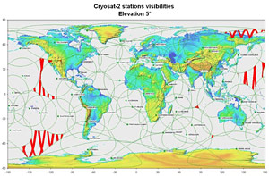
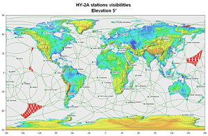
Cryosat-2   HY-2A

Cryosat-2 DORIS stations visibilities, elevation 5°:


HY-2A DORIS stations visibilities, elevation 5°:


Cryosat-2 DORIS stations visibilities, elevation 5°, and non covered ground tracks:


HY-2A DORIS stations visibilities, elevation 5°, and non covered ground tracks:


Empty
  •  Print 
Details
Last Updated: 16 January 2025
feed-image Feed Entries

Documentation

  • Table of documents
  • Newsletter
  • Bibliography
  • Outreach material
  • Activity reports
  • Documents for the data analysis
  • Presentations at IDS meetings
  • IDS-related presentations
  • DORIS-related presentations

About DORIS

  • Tables of data and products
  • Discover DORIS (AVISO website)
  • List of stations (sitelogs)
  • List of satellites
  • Videos of satellites (IDS channel)
  • Maps of the network
  • Network on Google Earth

Monitoring

  • Visualize products time series
  • Table of system events
  • MOE statistics
  • POE statistics
 
 
ICSU-WDS
ICSU-WDS
ICSU-WDS

logo cnes

Site Map |  Contact |  Citation |  Mails |  FAQ |  Glossary
Copyright © 1999-2025 CNES-CLS. All Rights Reserved.