Here is a selection of maps of the DORIS network.
sites | colocations | satellite tracks | stations visibilities
DORIS sites
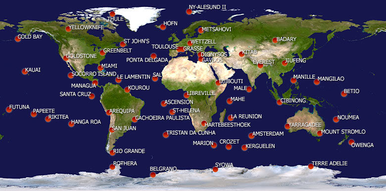
| Map of the current DORIS network |
 |
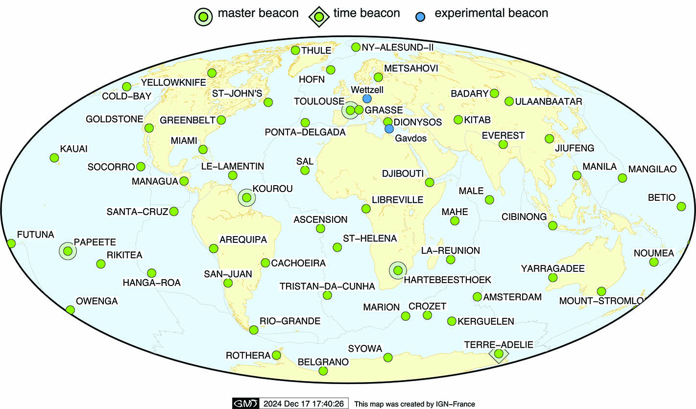
| DORIS sites (as of December 2024) |
 |
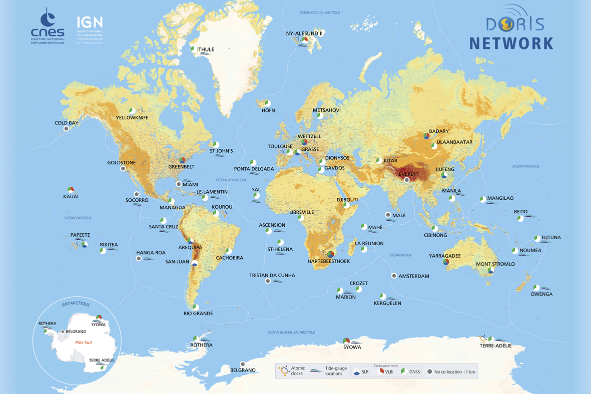
| DORIS network 2025 |
 |
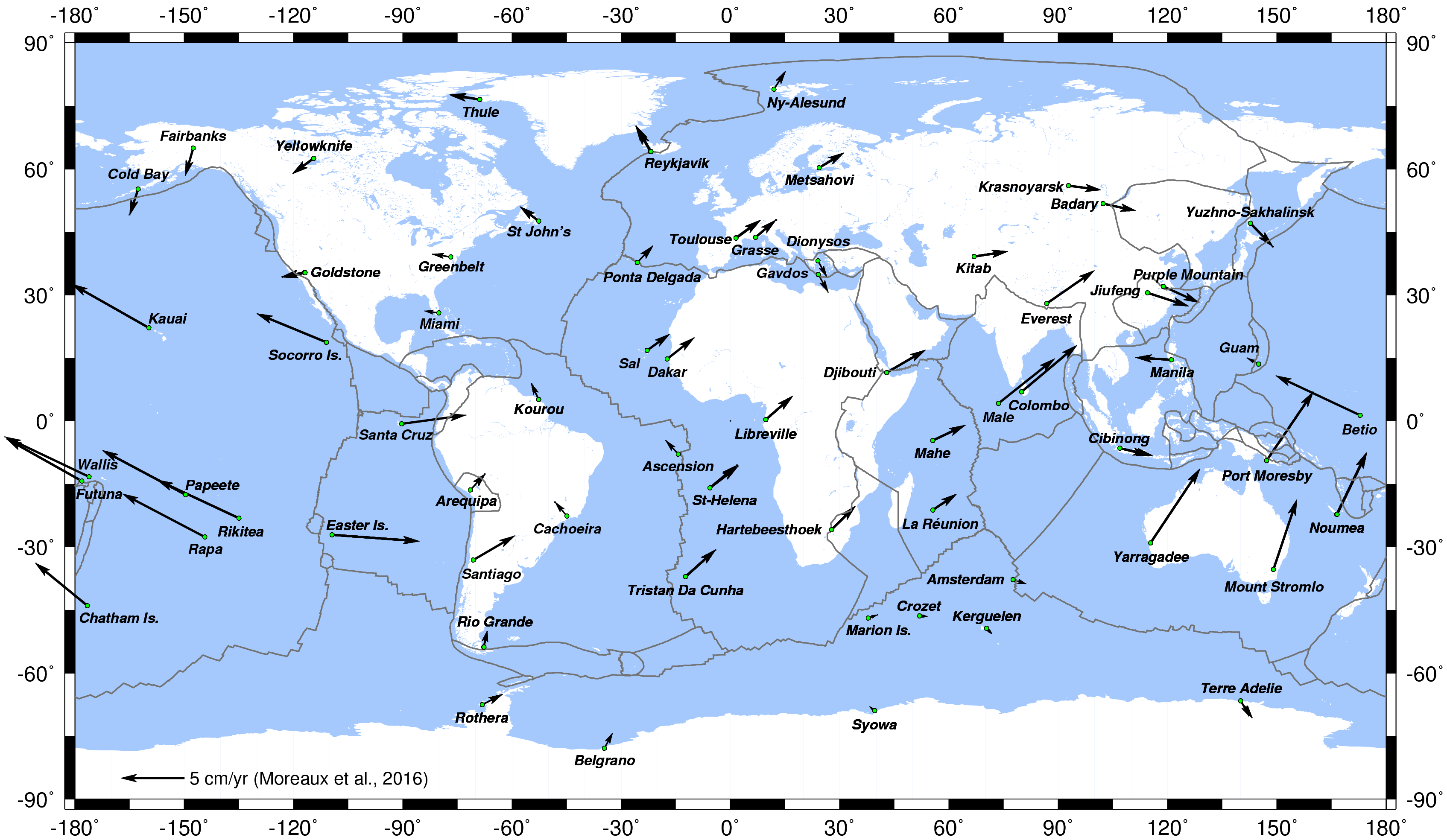
| Horizontal displacement of the DORIS stations (Moreaux et al., 2016) |
 |
DORIS colocations
| DORIS stations co-located with other IERS techniques and tide-gauges (as of Sep. 2024) |
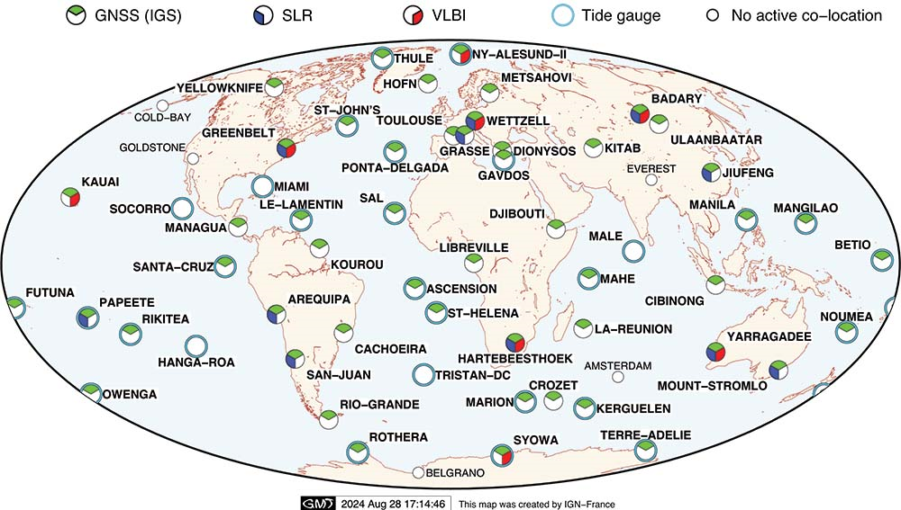 |
| DORIS and tide-gauges colocations (as of Sep. 2024) |
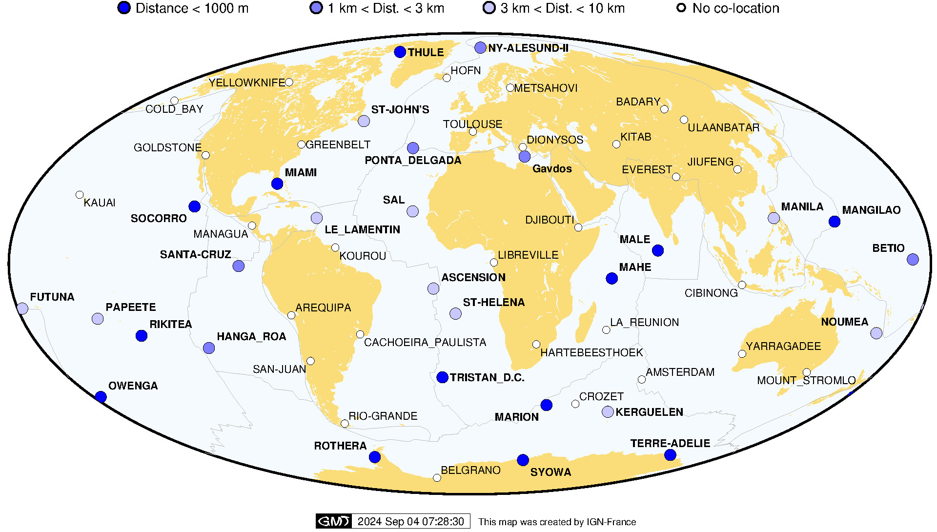 |
|
DORIS stations co-located with other techniques (VLBI, SLR, GNSS) (as of Sep. 2024) |
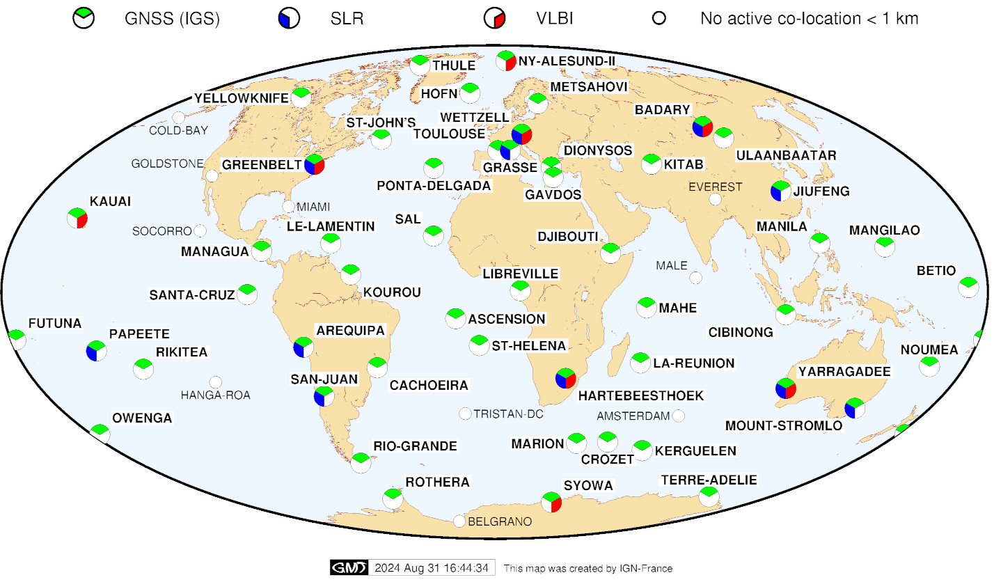 |
| DORIS network and Earthquakes since 1990 (as of Jan. 2025) |
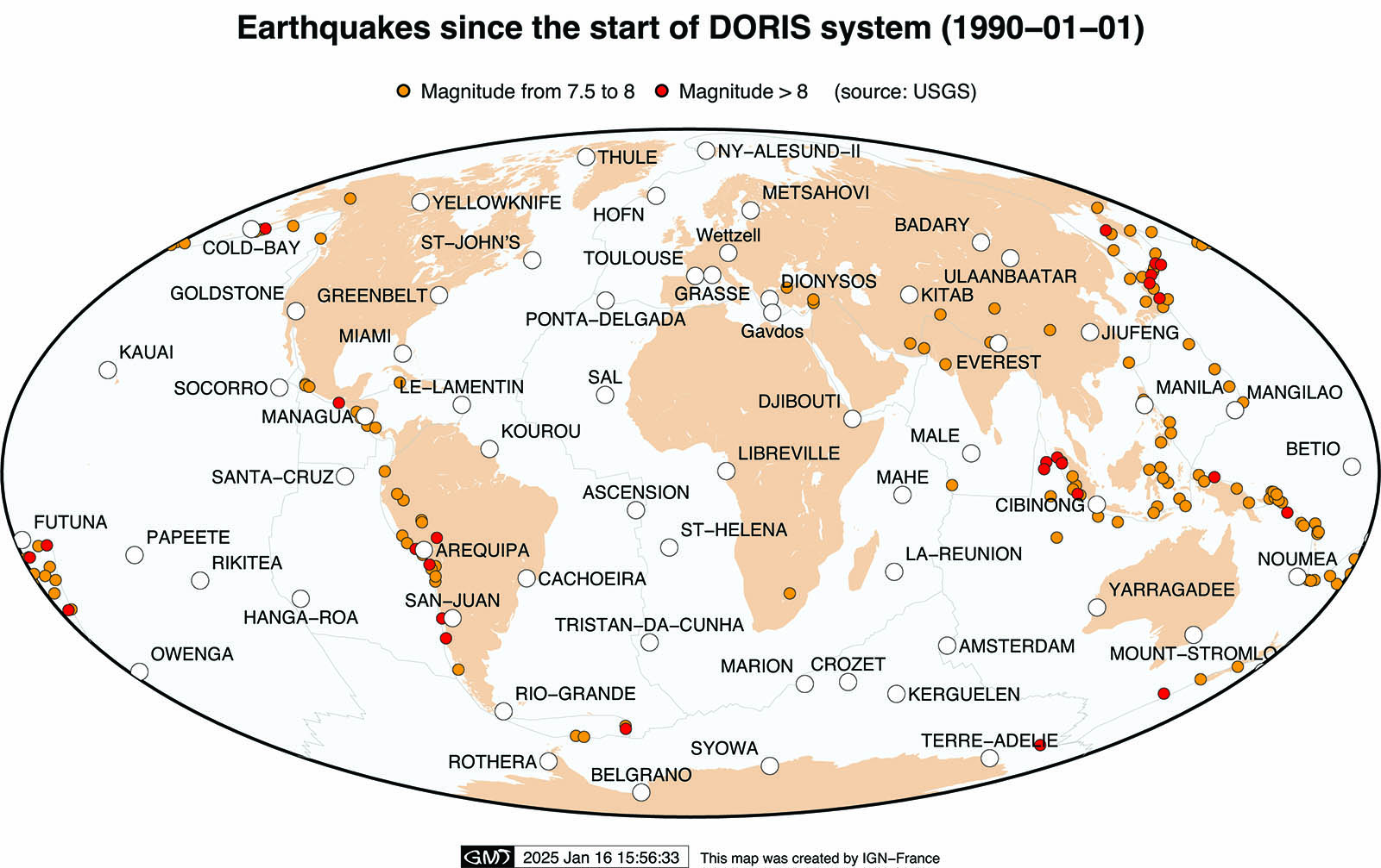 |
Satellite tracks
for 1 day (from 23/01/2025 14h TAI to 24/01/2025 15h TAI)
![]()
|
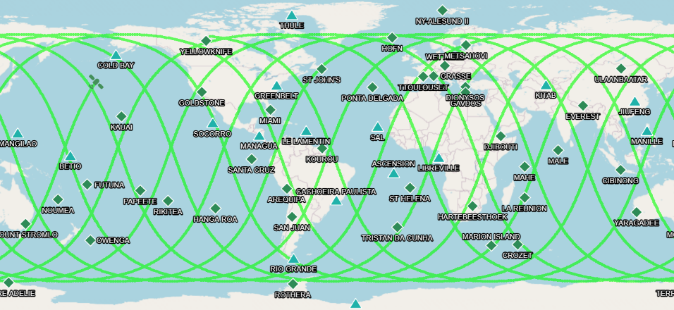
Sentinel-6A: 66 deg. inclination (1336 km altitude) |
|
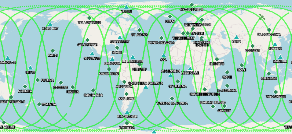
Swot: 77 deg. inclination (~890 km altitude) |
|
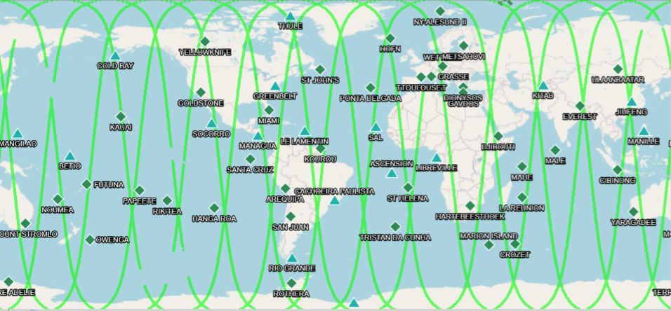
Cryosat-2: 92 deg. inclination (~700 km altitude) |
|
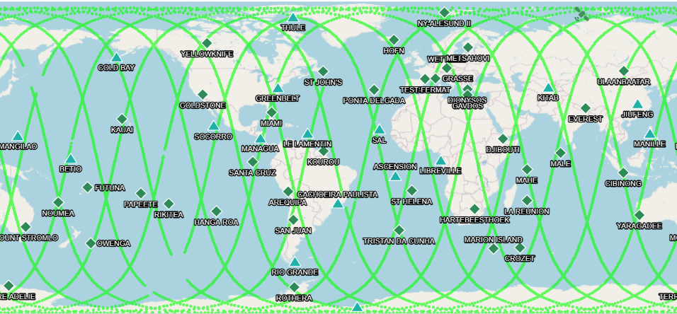
Sentinel-3B: 98 deg. inclination (~800 km altitude) |
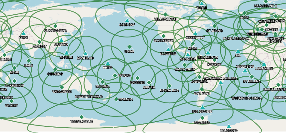
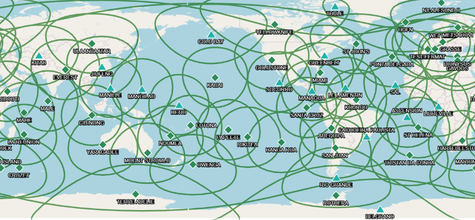
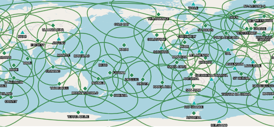
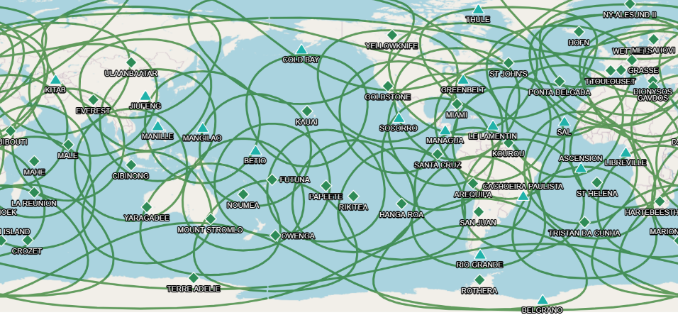
DORIS stations visibilities, elevation 5°
for 1 day (from 23/01/2025 14h TAI to 24/01/2025 15h TAI)
![]()
|
Cryosat-2: ~700 km altitude (92 deg. inclination) |
|
Sentinel-3B: ~800 km altitude (98 deg. inclination) |
|
Swot: ~890 km altitude (77 deg. inclination) |
|
Sentinel-6A: 1336 km altitude (66 deg. inclination) |

