DORIS (Doppler Orbitography and Radiopositioning Integrated by Satellite) is a French civil uplink radio tracking system based on Doppler shift measurements on a dual-frequency signal transmitted by ground stations and received by orbiting satellites. It includes instrument packages onboard the carrying satellites (antenna, radio receiver, ultra-stable oscillator), a ground tracking network of autonomous transmitting stations (beacon, transmitting antenna) distributed uniformly over the terrestrial globe, and a control and processing center.
The DORIS system was designed and developed in the 1980s by CNES [Centre National d’Études Spatiales, the French space agency] and IGN [Institut national de l’information géographique et forestière, the French national survey and mapping agency] with support from GRGS [Groupe de Recherche de Géodésie Spatiale, a research group in the field of space geodesy] to meet new needs for precise orbit determination of Earth observation satellites. In particular, DORIS was designed with the initial aim to determine the satellite's position in space with a target radial orbit accuracy of 10 cm. Accurate radial orbit knowledge is essential for determining sea surface height using radar altimetry. The radial orbit accuracy achieved from DORIS has progressed steadily to reach less than 1 cm on the latest missions. It is interesting to compare this precision with the precision obtained at the beginning of the space age, where the the satellite position was estimated close to 20 km then close to 20 meters in the 80's.
DORIS has also proven to be very useful for geodesy and geophysical applications. Technological and methodological improvements have made it possible to improve estimates of DORIS ground station positions, Earth rotation parameters and other geodetic variables such as geocenter and scale of the International Terrestrial Reference Frame (ITRF).
Since 1998, the Diode navigator has added real-time measurement processing capability for satellite navigation.
GENESIS
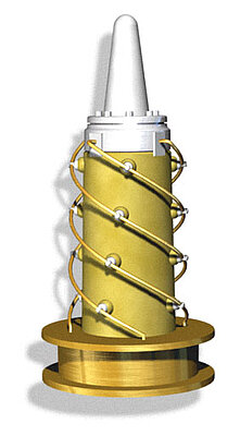
Doris receiving antenna under the satellite. It receives signals from the terrestrial beacons network (its length is 42 cm).
Credits Mira Productions.
