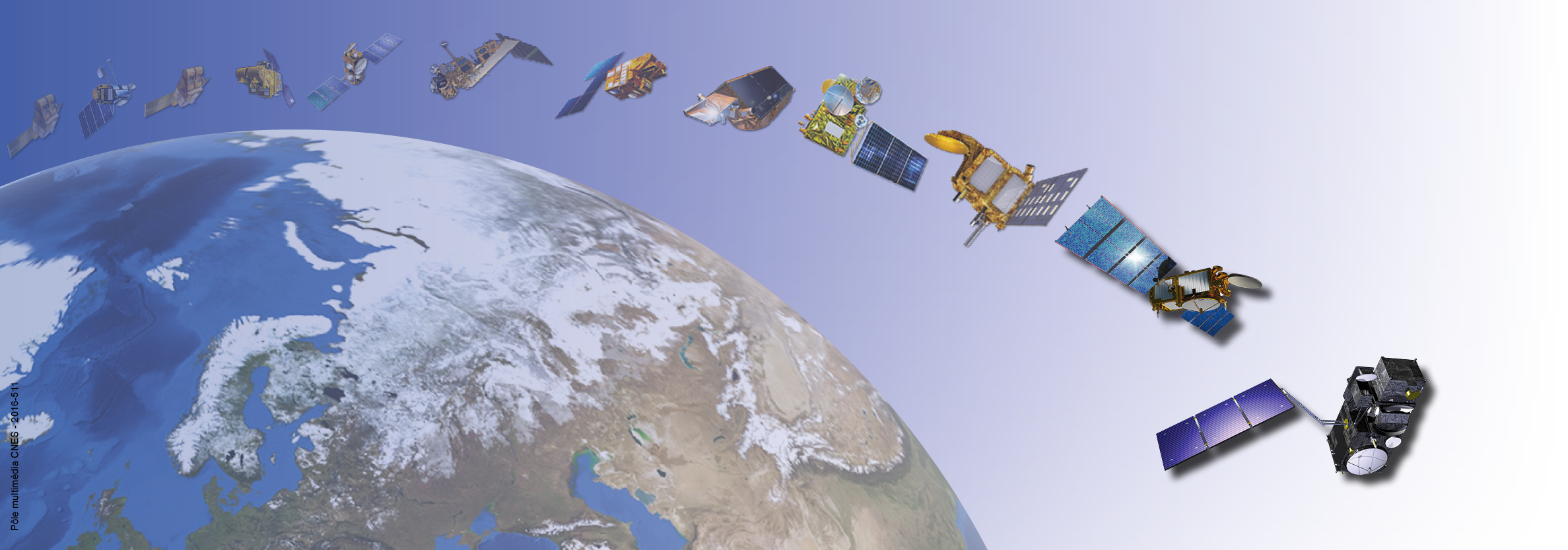

DORIS (Doppler Orbitography and Radiopositioning Integrated by Satellite) is a system developped for precise orbit determination and precise ground location.

DORIS is onboard the Cryosat-2, SARAL, Jason-3, Sentinel-3A, Sentinel-3B, HY-2C, HY-2D, Sentinel-6A and SWOT altimetric satellites. It also flew with SPOT-2, SPOT-3, SPOT-4, SPOT-5, TOPEX/POSEIDON, ENVISAT, Jason-1, Jason-2 and HY-2A.
IDS is an international service which provides a support, through DORIS data and products, to geodetic, geophysical, and other research and operational activities.

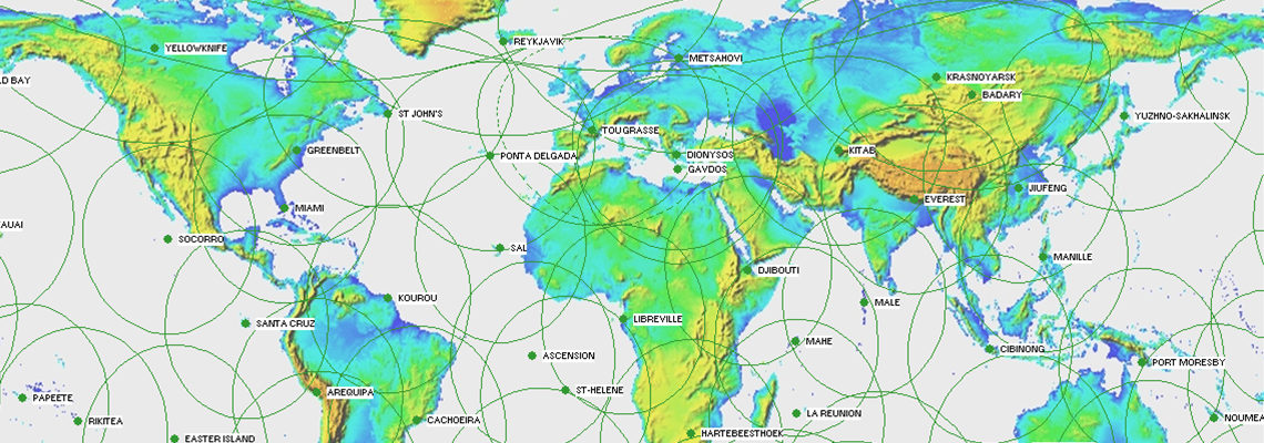
Ground network, stations, sitelogs, maps, network viewer, station position times series.
Whenever you use IDS data, products, or results in a publication, please include a proper citation.
To subscribe to the newsletter, please send an e-mail to IDS Central Bureau.
For more information about the IDS or for any question, send an email to the IDS Central Bureau.
New point at Kerguelen (KEZC) The DORIS antenna at KERGUELEN Islands (French Southern and Antarctic Lands) has been...
The IDS report 2024 is out and available through the DOI ...

![]()


